COURSE INTRODUCTION
COURSE 02 Tour de Kunisaki A & B Course
Feel the wind through the Kunisaki Peninsula, where abundant nature and unique religious traditions come to life!
Tour de Kunisaki is one of the best ways to enjoy Kunisaki Peninsula. The A Course takes you around the whole peninsula on the coast, giving you great views of the Seto Inland Sea. You can also enjoy the easy-to-ride Orange Road, known for its lack of traffic. The B Course runs through the center of the peninsula.Take Prefectural Road 31, which cuts through the Ota region, for some beautiful scenery of serene rice fields. Crossing its highest point, Hashirimizu Toge (428m) will bring you to the coastal portion of this relatively tough 100 km course.
View in Google MapsDATA
- Distance to Travel
- 257km
- Average Incline (Climbs)
- 3.8%
- Average Incline (Descents)
- 4%
- Elevation Gain (Climbs)
- 3,105m
- Elevation Gain (Descents)
- 3,100m
CYCLE MAP
Spot Information
-

Cycle Stand
-

Air Pump
-

Tools
-

Restroom
-

Drink Supplies
-

Information
-
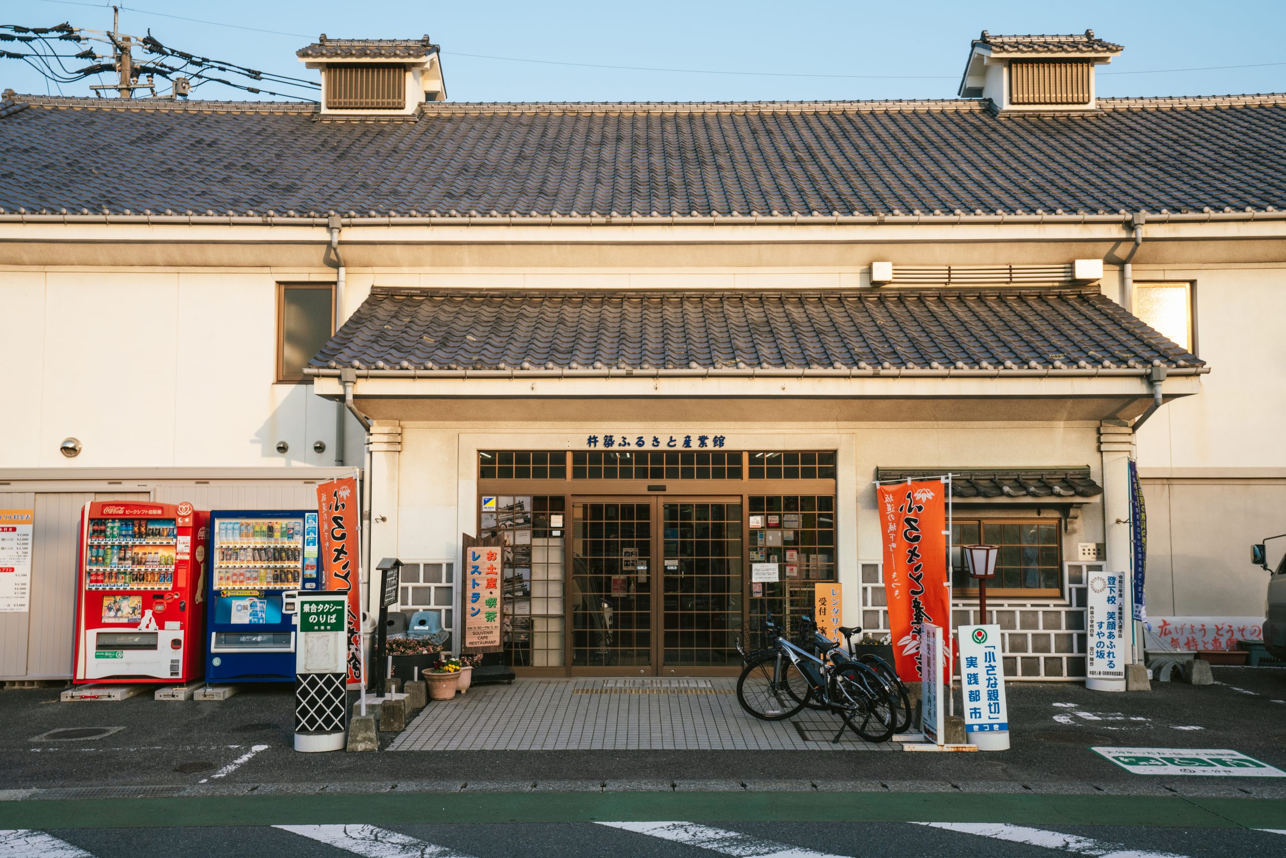
Kitsuki Furusato Industry Hall
A sightseeing hub for Kitsuki city, Kitsuki Furusato Industry Hall offers a variety of specialty products and tourist information. The restaurant next door also serves local Kitsuki seafood for you to enjoy. There are also rental bicycles available, making it a perfect base for your cycling adventure.
Spot Information
- Address
- 665-172 Kitsuki Oita
- Phone Number
- (+81)-978-62-2000
- Hours
- 9:30~17:30(2026/4/1~ 9:30~17:00)
- Regular Holiday
- 12/31~1/2
-
-
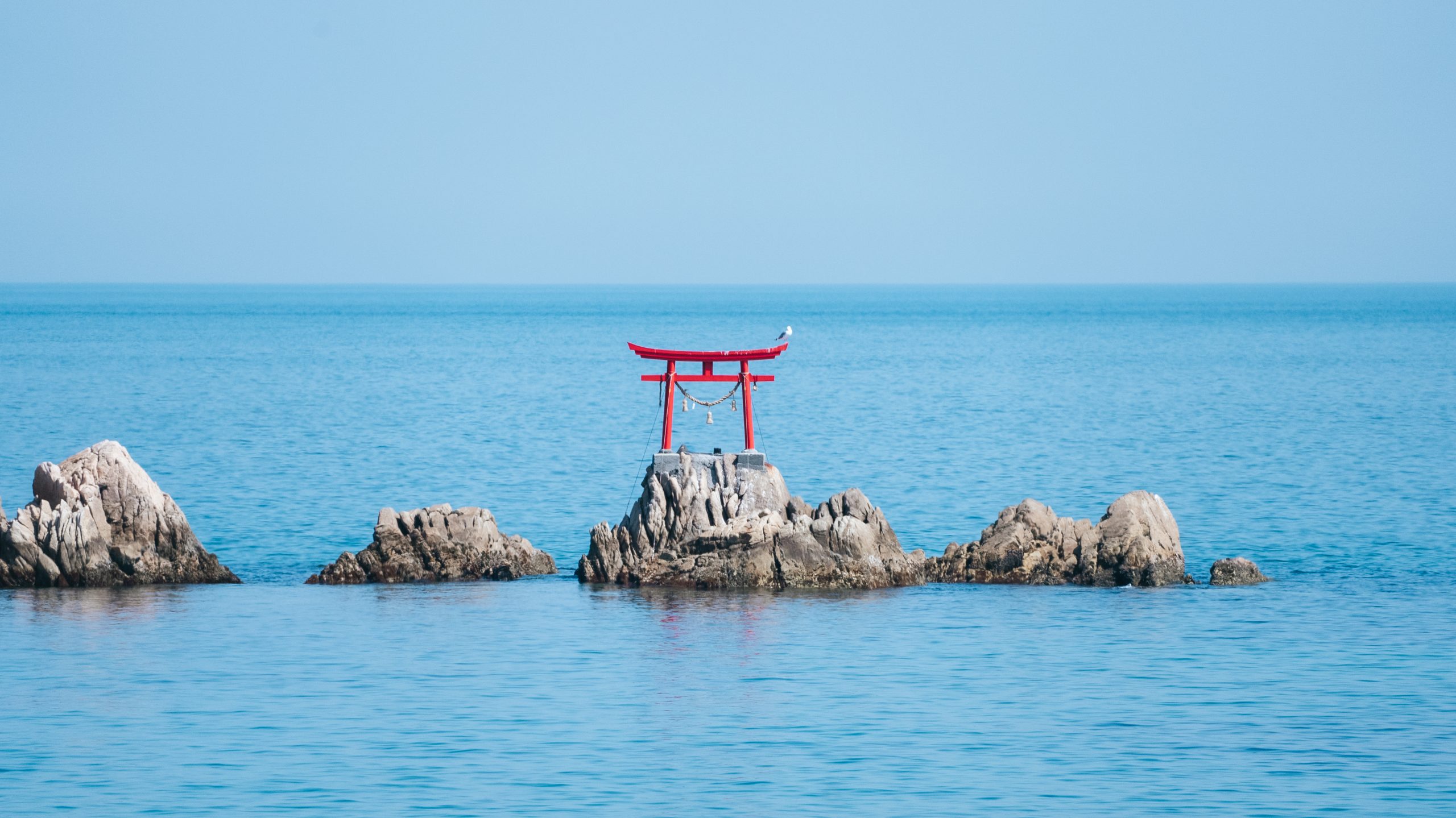
Hachiman Nadagu
Situated in front of the Nata coast, Hachiman Nadagu is a prestigious shrine dedicated to the warrior deity Hachiman. See a tranquil sunrise, or relax in its serene pine grove and immerse yourself in its ancient history.
Spot Information
- Address
- 299 Nata, Kitsuki City
- Phone Number
- (+81)-978-63-0100
- Hours
- Open at all times
- Regular Holiday
- None
-
-
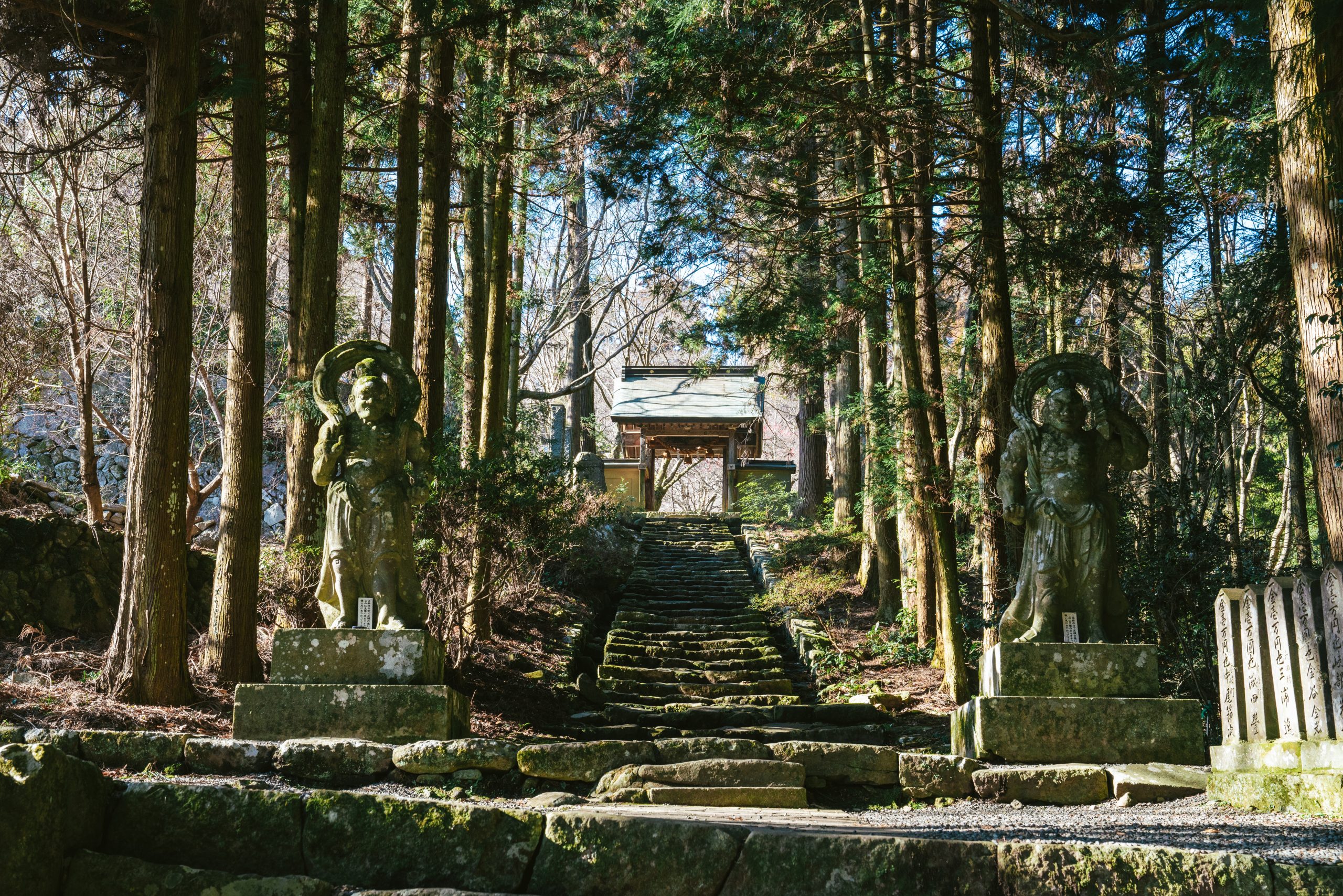
Futago-ji
Futago-ji flourished as the central temple of Kunisaki Rokugo-Manzan. Enter the temple grounds in fall to be greeted by the wonderous colors of a dignified maple tree, and an enormous statue of Nio.
Spot Information
- Address
- 1548 Akimachi Futago
- Phone Number
- (+81)-978-65-0253
- Hours
- 8:30~16:30
- Regular Holiday
- Closed during stormy weather (typhoons, snowfall, etc.)
-